


.
By: Ana Beatriz Tuma*
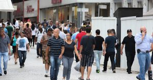
 From Parque Ecológico do Tietê to Avenida Paulista, from USP’s Butantã campus to Anhangabaú and many other locations in São Paulo, the photographic collection of the collaborative platform Arquigrafia reveals the city’s many urban transformations over the decades. Arquigrafia is a thematic project based at USP’s Faculty of Architecture and Urbanism and Design (FAU), funded by the São Paulo Research Foundation (Fapesp). To explore the platform and view the images, registration is required by clicking here.
Complementing this visual journey into São Paulo’s past, the Arquigrafia team developed a 3D digital model of the Historic Center as a pilot project. The model reveals rhythms, dynamics, and temporal layers that are not always captured by traditional approaches to urban history.
A city that rewrites itself
“What is perceived is that São Paulo, as of 1880, started a process of rewriting its urban landscape, erasing the colonial city of rammed earth and replacing it with a brick city at the beginning of the Republic, at the beginning of the 20th century, and starting a process of verticalization from the 1920s, scratching the skies and erasing the previous stages”, says Beatriz Bueno, professor at FAU and researcher associated with Arquigrafia.
The professor explains that the city, which was concentrated on the Historic Hill between the Tamanduateí and Anhangabaú rivers, became the centre and expanded beyond the rivers in all directions. “As of 1930s, this centre is no longer the only center: it is the old center and gives way to the new centre, the region immediately surrounding Barão de Itapetininga.” Later, in the 1950s and 1960s, another centrality emerged: Avenida Paulista and, later, Avenida Brigadeiro Faria Lima.
“So, it is a city that not only rewrites itself, but also changes its centralities. A city whose metamorphosis and the dynamics of this metamorphosis are unparalleled in other cities in the world,” says Beatriz.

.
The transformations that have been taking place in São Paulo can be seen up close in Arquigrafia. “As the images available on the Arquigrafia collaborative platform are related to a geographical position, it is possible to follow this same place in different configurations in time,” says Artur Rozestraten, professor at FAU and coordinator of the thematic project. This location data, such as street, city and state, is contained in all the photographs in the lower right corner of each of them next to a map.
“I will give as an example the changes that have occurred in Vale do Anhangabaú in the last decades. So, when we search in Arquigrafia with the term ‘Anhangabaú‘, we see different photographs, showing different configurations, and, thus, we can follow the transformations and perceive the urban morphology in motion based on a photographic iconography,” explains Rozestraten.
Based on that, he explains that several stories of the capital of São Paulo can be told through photographs. One of them is “the acceleration of the transformation of our urban spaces in the city of São Paulo, as neighborhoods that had a basically residential configuration, with single-storey houses and townhouses, as they have become very vertical in recent decades”. These transformations are visible, for example, in neighborhoods such as Pinheiros, Vila Madalena and Vila Pompeia.

.


.
Transformations in motion
The Historic Centre of São Paulo changed very quickly over time. To highlight this, Sayed Samimi, a level V technical training (TT-V) fellow at Arquigrafia, in cooperation with professors Beatriz Bueno and Artur Rozestraten developed an animated video with a 3D digital model of the place, organized in a timeline. The work was based on historical maps, bibliographic research and field surveys.
The video captures the evolution of São Paulo’s Historic Center from its early stages to recent years. “It allows viewers to understand the replacement of generational urban layers and the accelerated transformation and verticalization of the city’s landscape,” explains Samimi. This is made possible by the 3D digital model, which incorporates building heights and documents the demolition of older structures and their replacement with taller ones.
“The video shows how this rapid transformation intensified throughout the 20th century and continues to this day. The purpose of its creation is to shed light on these changes and expand understanding not only among scholars in the area, but also among citizens interested in the conservation of historical heritage”, clarifies the Arquigrafia fellow.
Beatriz Bueno points out that the 3D digital model makes it possible to “see the city in the process of metamorphosis and this seems to me very rich for us to perceive rhythms, dynamics and mutation batch by batch”. She recalls that “in some batches, we sometimes have four cities in a century. The city of rammed earth is replaced by that of brick, that of brick by that of concrete, and, once again, concrete is replaced by a taller building”.

.
Thus, the professor says that this model can be a warning to show a city that destroys itself, discarding its heritage. “On the other hand, it can be an instrument of management and formulation of public policies, a repository of hyperconvergence of data that can assist preservation and planning institutions in their public policies for the centre.”
And what will be the future of the 3D digital model? The professor says that the idea is to put in such a model the architectural treasures of São Paulo that were part of an exhibition that took place in May at the Council of Architecture and Urbanism of São Paulo (CAU/SP).
This will all be within Arquigrafia. That’s what Sayed Samimi says. “Users will be able to explore the history of the venue through interactive timeline features. They will be able to navigate through different periods and contribute to the enrichment of this collaborative digital environment.”
To follow the activities promoted by the Arquigrafia team, visit their Instagram page.
* JC-IV Fellow with FAPESP Thematic Project Arquigraphy Experience 4.0 and research fellow at Faculty of Architecture and Urbanism
English version: Nexus Traduções, edited by Denis Pacheco